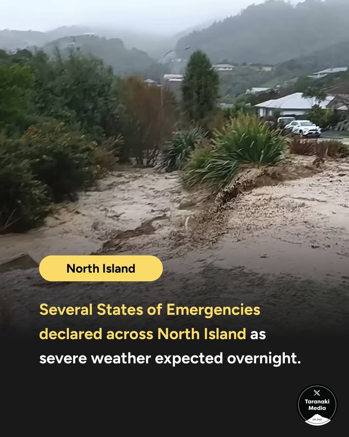

⚠️ A Regional State of Emergency has been declared for the entire Manawatū-Whanganui region, covering a massive area from Ruapehu down to Horowhenua and across to Tararua. This follows earlier local emergency declarations in the Manawatū, Rangitīkei, and Tararua districts. Waikato is also in the firing line, with States of Emergency declared in Ōtorohanga and Waipā.
MetService has issued a Red Heavy Rain Warning (the highest possible alert) for the Manawatū, Rangitīkei, and Ruapehu Districts as a severe weather event is expected overnight.
Forecasters are predicting between 140mm and 180mm of rain to dump on these areas, mainly in the ranges. The run-off is expected to rapidly swollen major rivers including the Manawatū, Rangitīkei, and Whangaehu. Emergency services are warning of a genuine "threat to life" from dangerous river conditions and widespread landslides.
Manawatū-Whanganui Civil Defence Group Controller Michael McCartney says the regional declaration was a necessary precautionary step. "We don’t know for certain that we will need to make use of these emergency powers, but given the potential for the main impact of this event to happen overnight, we've made the declaration now," he said.
These powers allow authorities to evacuate premises, close roads, and requisition equipment if the situation deteriorates rapidly in the dark.
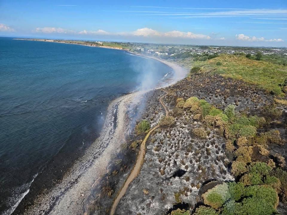
The storm system has already turned deadly. Tributes are flowing for Brent Knowles, a "loving father" who died after his vehicle was submerged in floodwaters on State Highway 39 on Friday. The intense weather in the Waikato has also left the coastal town of Kāwhia completely isolated due to multiple slips, according to the Ōtorohanga District Council.
Interislander and BlueBridge have cancelled ferry sailings for Sunday night and Monday due to gale-force winds and predicted swells of up to seven metres.
In the capital, Air New Zealand has cancelled all regional flights in and out of Wellington for the remainder of Sunday. "Safety is paramount, and these conditions are outside our operating limits for our regional aircraft," said Chief Operating Officer Alex Marron. Jet services are continuing for now, but passengers are being warned to watch for further disruptions.
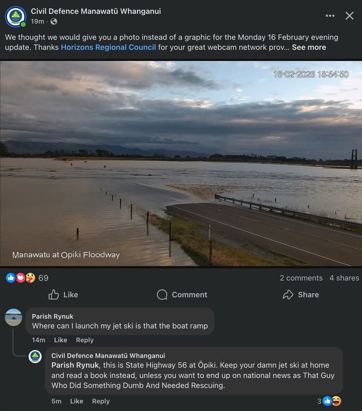
On the roads, State Highway 2 between Wairoa and Gisborne closed at 8pm tonight and will remain shut until at least 7am Monday. NZTA says the road is already fragile from previous storms and they cannot risk public safety. In Hawke's Bay, State Highway 51 is closed between Hastings and Clive due to a large fallen tree and downed powerlines. Closer to the central plateau, the Napier-Taihape Road is closed, and warnings are in place that SH3 at Whangaehu and SH56 at Ōpiki could become impassable by morning.
Over on the East coast, Tairāwhiti and Hawke's Bay are under Orange Heavy Rain Warnings. With the ground already saturated from weather events just weeks ago, the threshold for new slips and surface flooding is incredibly low. Residents in low-lying areas, particularly near the Ōroua and Pohangina Rivers, have been advised to move stock to higher ground immediately. Federated Farmers' Andrew Hoggard posted a blunt warning to locals: "Suggest you play it safe and move stock off bottom flat paddocks."
Niwa is warning of wind gusts exceeding 130km/h in exposed areas overnight.
For anyone looking to travel Monday morning, check the Waka Kotahi journey planner before you leave.
The combination of darkness, high winds and rapidly rising floodwaters means the worst impacts of the storm are likely to be felt in the early hours of Monday morning.